

Emmy Winning Meteorologist l Founder of Raining Angels | James 4:10 | Nature lover | Artist | Author of “Under the Weather” Purchase it: https://teapaw.org/t.co/KMveN4qKBr
Dayton, OH
Joined July 2011
- Tweets11.8K
- Following1.7K
- Followers4.3K
- Likes11.8K


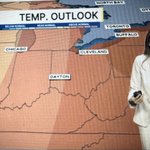


Tomorrow will be like Christmas.
Why?
Because I will have NO more useless commercials, lying cardstock and annoying political texts.
Happy Election Day my friends!
Britley Ritz retweeted

‼️ Flash Flood Emergency Continues
In all my year’s as a Meteorologist, I’ve NEVER seen anything like this. Multiple cities have seen 12-24” of rain, without a Tropical Storm, and it just won’t stop. ~2 feet in Palm Bay & Melbourne.
As I write this torrential bands are setting up again in Central and East #Florida dumping more #flooding rain. We’ve seen many 1-in-1000 year events in the last 2 days. Entire neighborhoods are experiencing catastrophic floods!
This is due to the Super #ElNino on top of a warmed atmosphere. With an El Niño this intense - by far the strongest we have ever seen - Expect the unexpected.

Britley Ritz retweeted

Wow, Barbara Lennon sent in this video, showing how her backyard is no more… so to speak…
She did also send pics of her smiling, so at least she’s trying to make the best of what’s around.


Britley Ritz retweeted
🌀AI Models Dominate Isaias Forecast
By now you’ve heard that Google Deep Mind nailed the #Hurricane #Isaias track forecast, but this shows just how dominant it was. The graph shows the forecast error… less error = more accurate.
~72 hours before landfall out the Google Deep Mind AI ensemble was only off by 19 miles, Euro AI by only 36 miles! There are lots of negative uses of AI, but weather forecasting is one example in which AI can be beneficial.


Winds of now 100mph.
Life threatening storm surge continues.

900 PM CDT Friday Oct 9 Update: Isaias moving across the western Florida Panhandle. Life-threatening storm surge and hurricane conditions occurring. Follow the latest on #Isaias at hurricanes.gov

Britley Ritz retweeted

HUGE SURGE hitting in Destin, FL! #FLwx
#Isaias makes landfall!
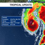
830 PM CDT Friday Oct 9 Update: Isaias makes landfall near Destin, Florida with maximum winds near 105 mph. Follow the latest on #Isaias at hurricanes.gov

This is insane!

BIRDS TRAPPED IN THE EYE 🌀🐦
Hurricane Hunters and Doppler Radar have confirmed that there are birds trapped in the eye of #Isaias right now because the winds are too strong in the eyewall. As a result, they stay within the calmer eye until reaching land. In this image, the blue colors are birds, the red color is rain. Unfortunately not all birds survive due to exhaustion, starvation or even drowning, but most do...especially depending on the type of bird. Landfall is this evening, so they just have to hold on for a little bit longer!

Britley Ritz retweeted

Live emergency update as inner core of category 3 Hurricane Isaias is pounding the barrier islands near Fort Walton Beach, Florida
#Isaias is intensifying! A well defined eye has show itself with the last few images.
This will likely become a CAT 3 sometime very soon.

This isn’t a good set up.
He’s right!
Panhandle and Big Bend friends, my thoughts are with you.

I am VERY concerned about this zone from Panama City to Tallahassee to Dothan, Alabama and Albany, Georgia. I actually think the impacts here may be more significant than in the eyewall.
Isaias's core is going to pass to the west, probably closer to Mobile or Gulf Shores (or even Pensacola). To the east, however, it will swirl robust tropical moisture northward and pinwheel a string of thunderstorms ashore.
High-resolution computer models suggest a feeder band (strip of downpours/thunderstorms swirling into Isaias) will take aim at the highlighted region for between 18 and 24 hours. Rainfall rates of 2 to 4 inches per hour are possible in the heaviest downpours within this band. I could easily see a narrow strip of 10 to 22+ inches of rain falling, causing locally significant to extreme flash flood cocerns.
If you find yourself under a flash flood emergency, it's a time to move IMMEDIATELY to the highest point you reasonably, and safely, can.
Models simulate plentiful convergence, or gathering/colliding air. When air is squeezed together, it is pushed upwards. That lifts moisture upwards into storms. That moisture then falls as extremely heavy rain.
Meanwhile, I also expect some tornadoes in this area, and the chance of an isolated significant (EF2+) tornado. Changing winds with height will help thunderstorm cells to rotate, and several tornadoes are possible. Machine learning models are highlighting this region too.
On Saturday afternoon, the threat will shift north toward Valdosta.
If a tornado warning is issued, seek shelter in an interior room away from windows as low as you can be without putting yourself at risk of flooding.

Waters at Destin beach as of 10AM Thursday.
Surf picking up and still some sun trying to peek through the clouds. Tomorrow morning the Emerald Coast will be sadly, completely different.
Winds now at 80 mph #Isaias
Hurricane #Isaias Advisory 7 (4 AM CDT, Thu Oct 8): NOAA Hurricane Hunters Indicate That Isaias Continues to Intensify. hurricanes.gov
